Saugatuck-Douglas
Area Maps
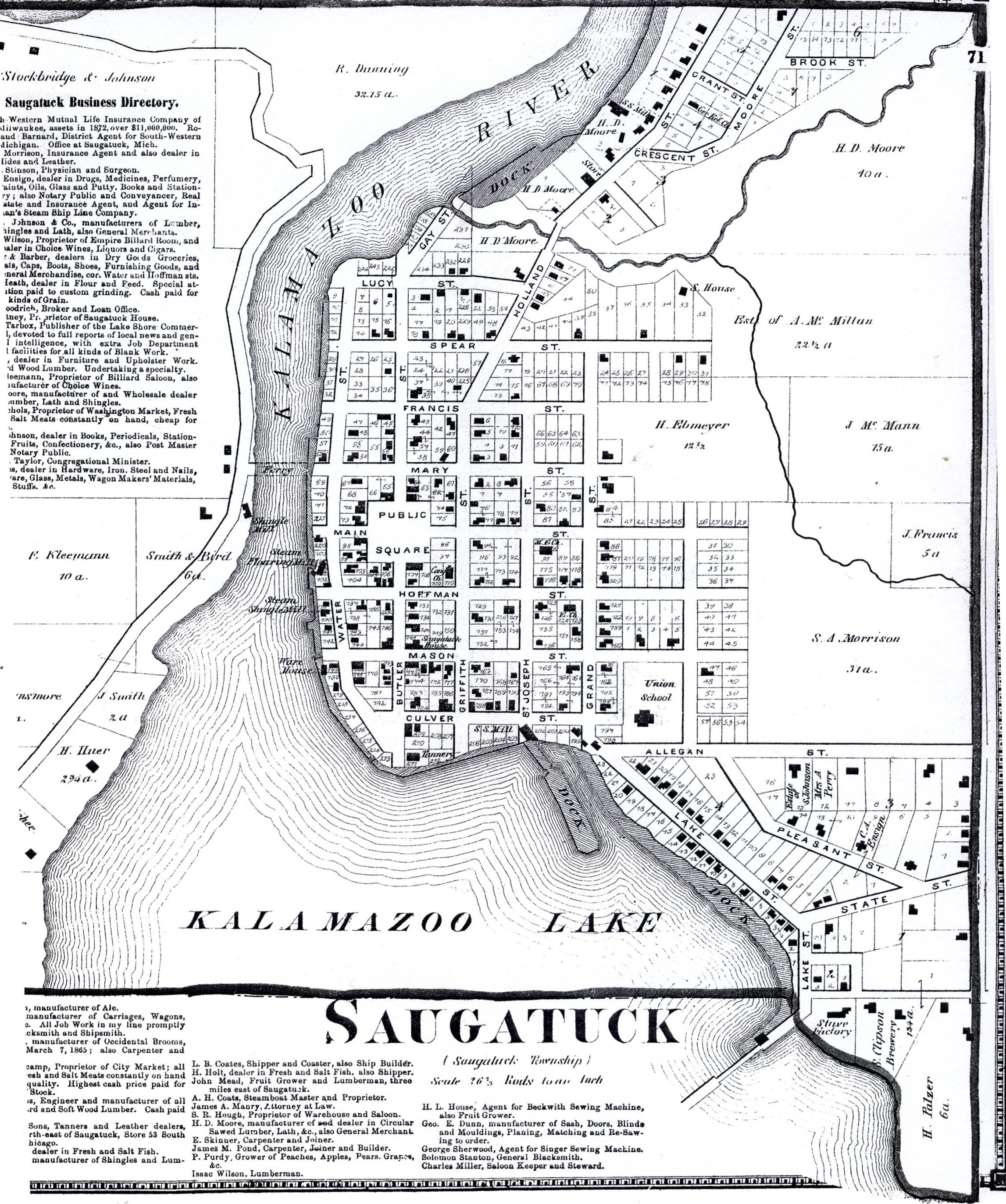
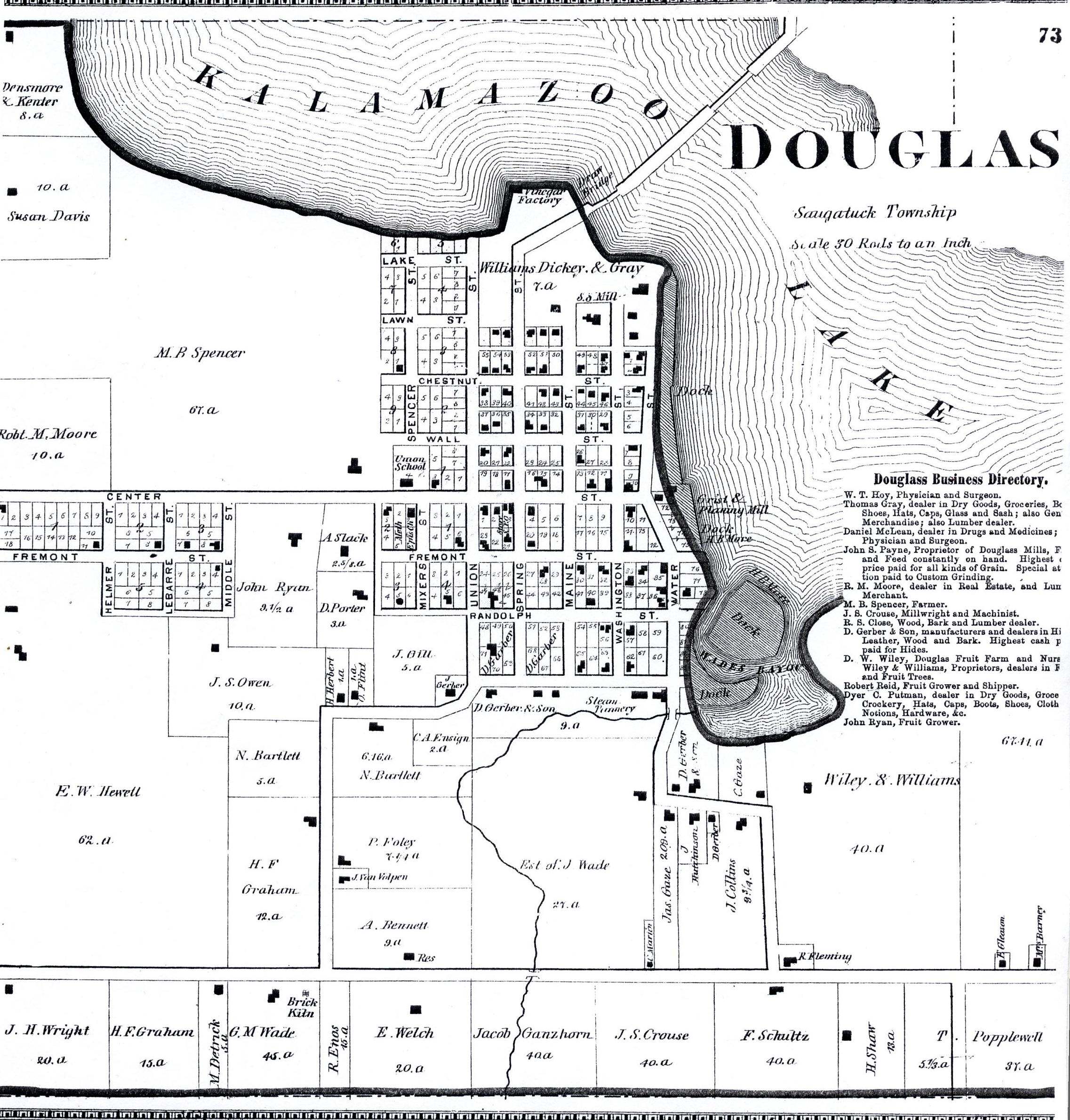
----1873- Western Allegan County
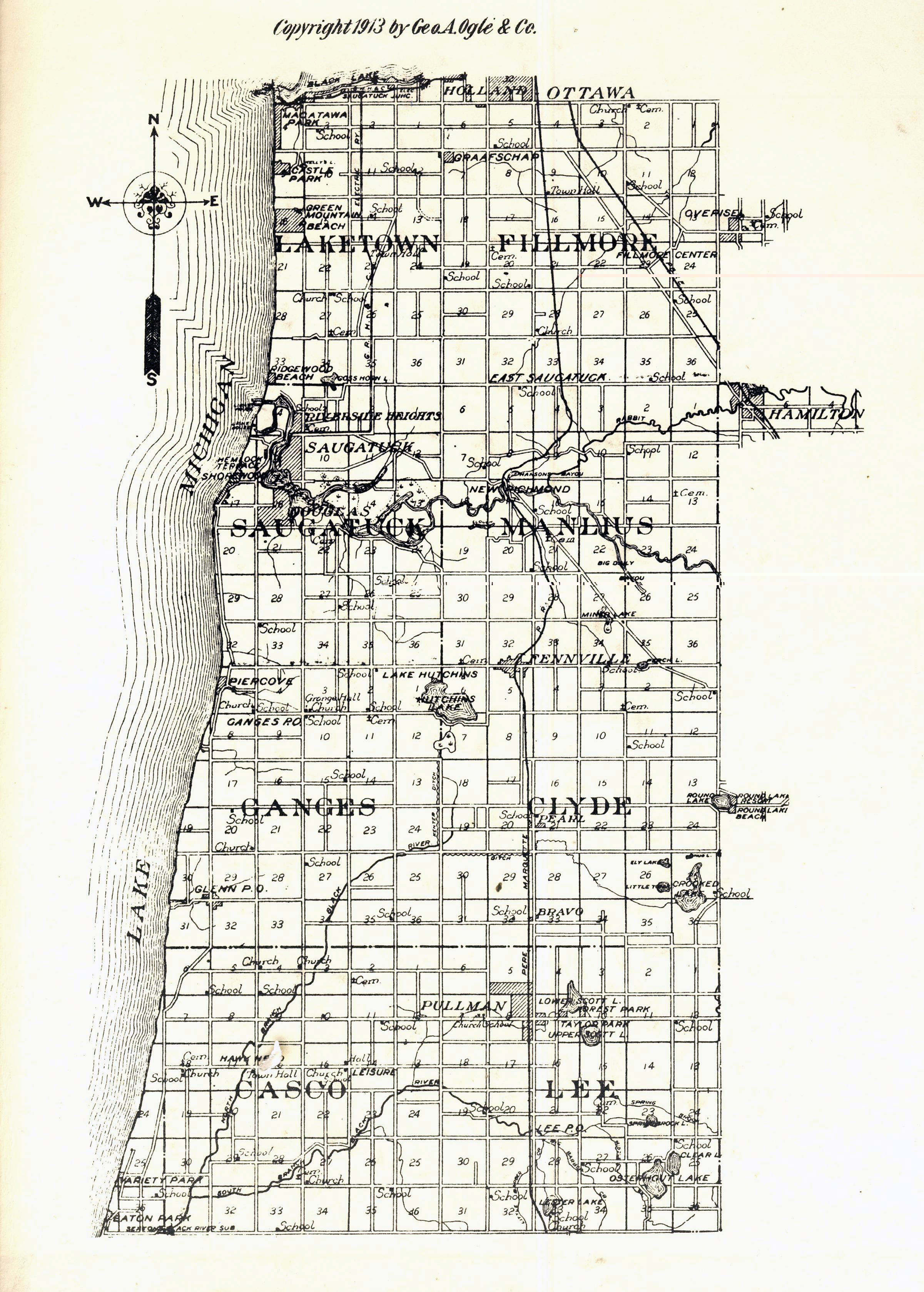
----1913- Western Allegan County
1873 Allegan Atlas
----Douglas Village
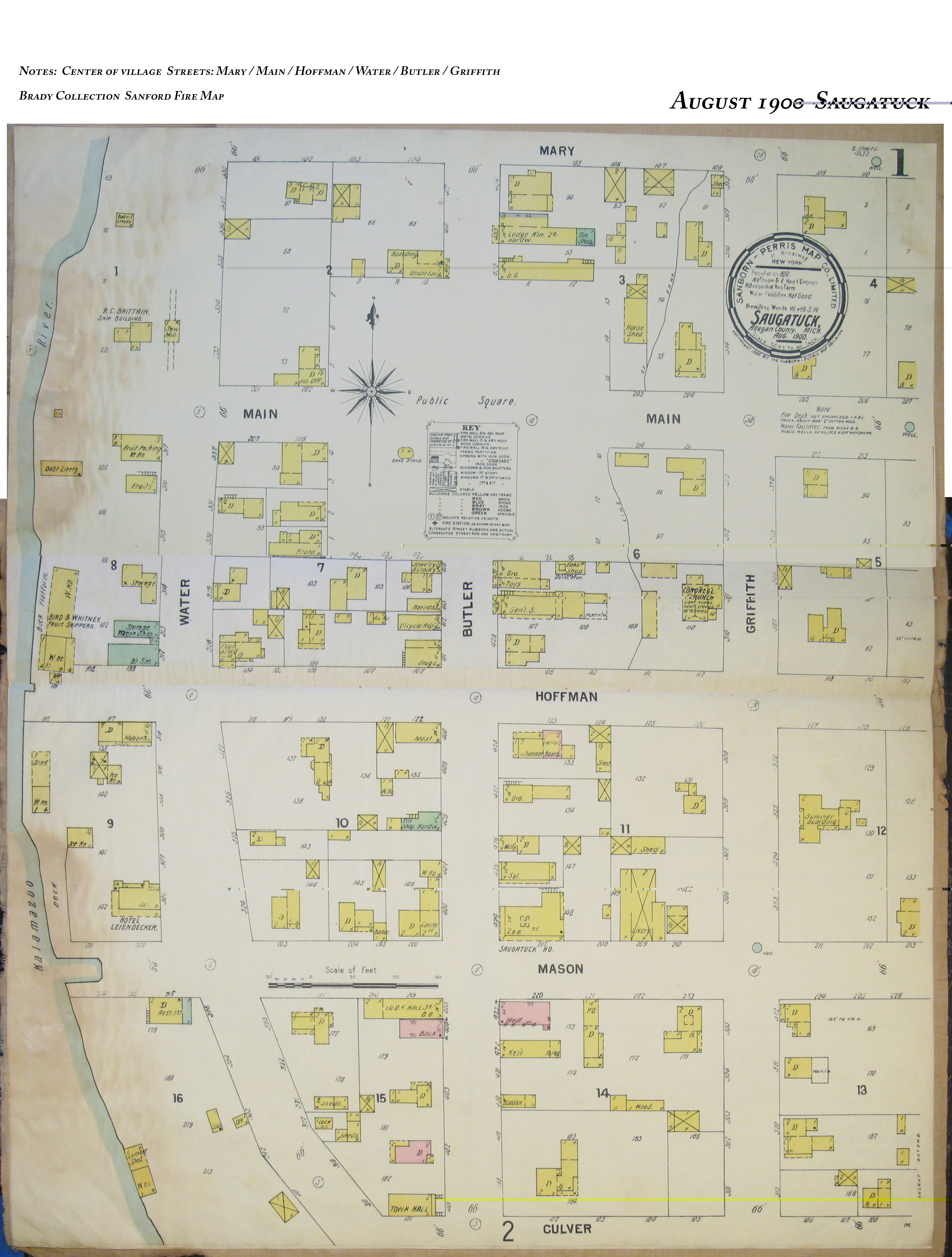
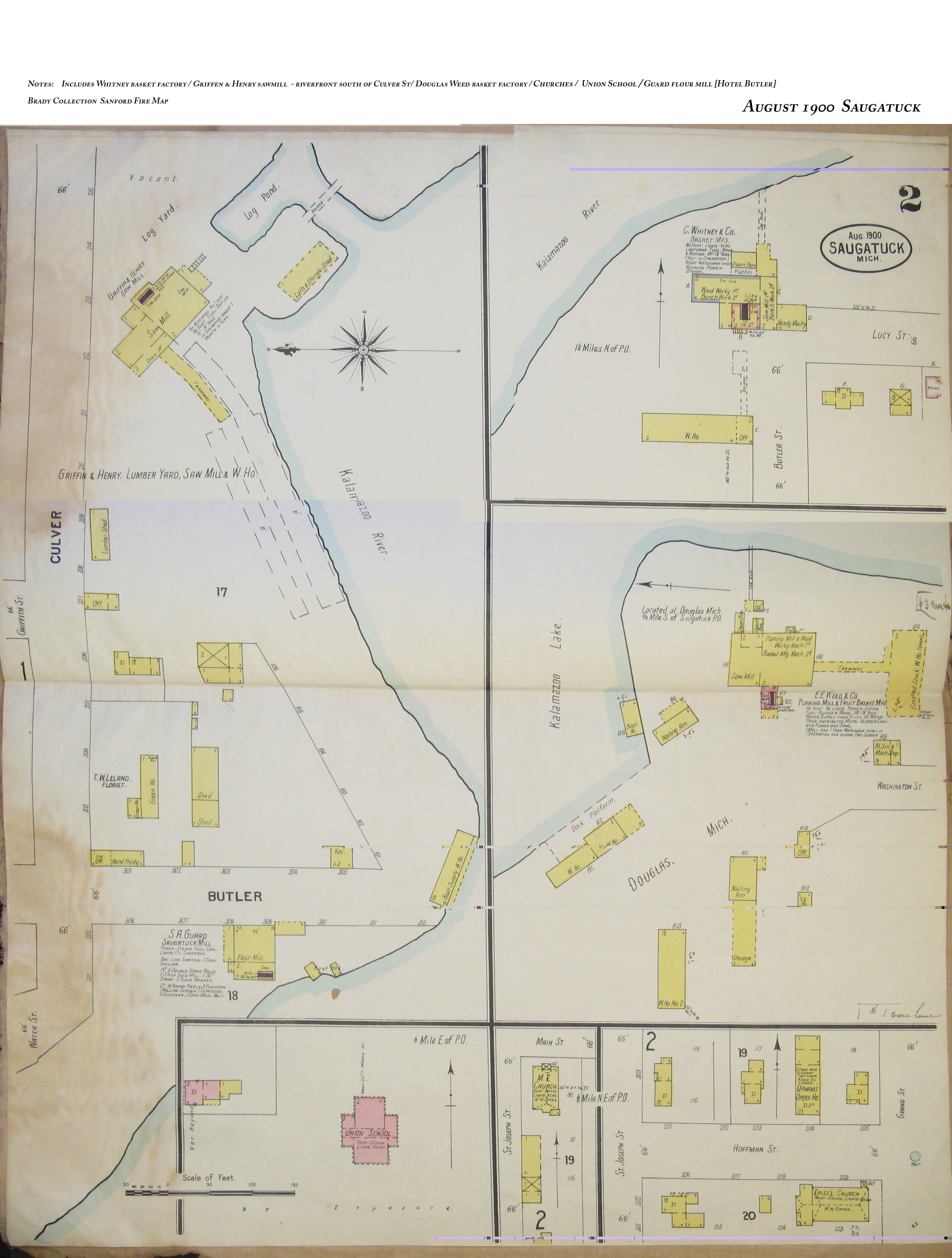
1900 August - Sanborn Insurance Maps from the Henry Brady Collection,
SDHS
----Saugatuck City Center-
Mary/Main/Hoffman/Water/Butler/Griffith Streets
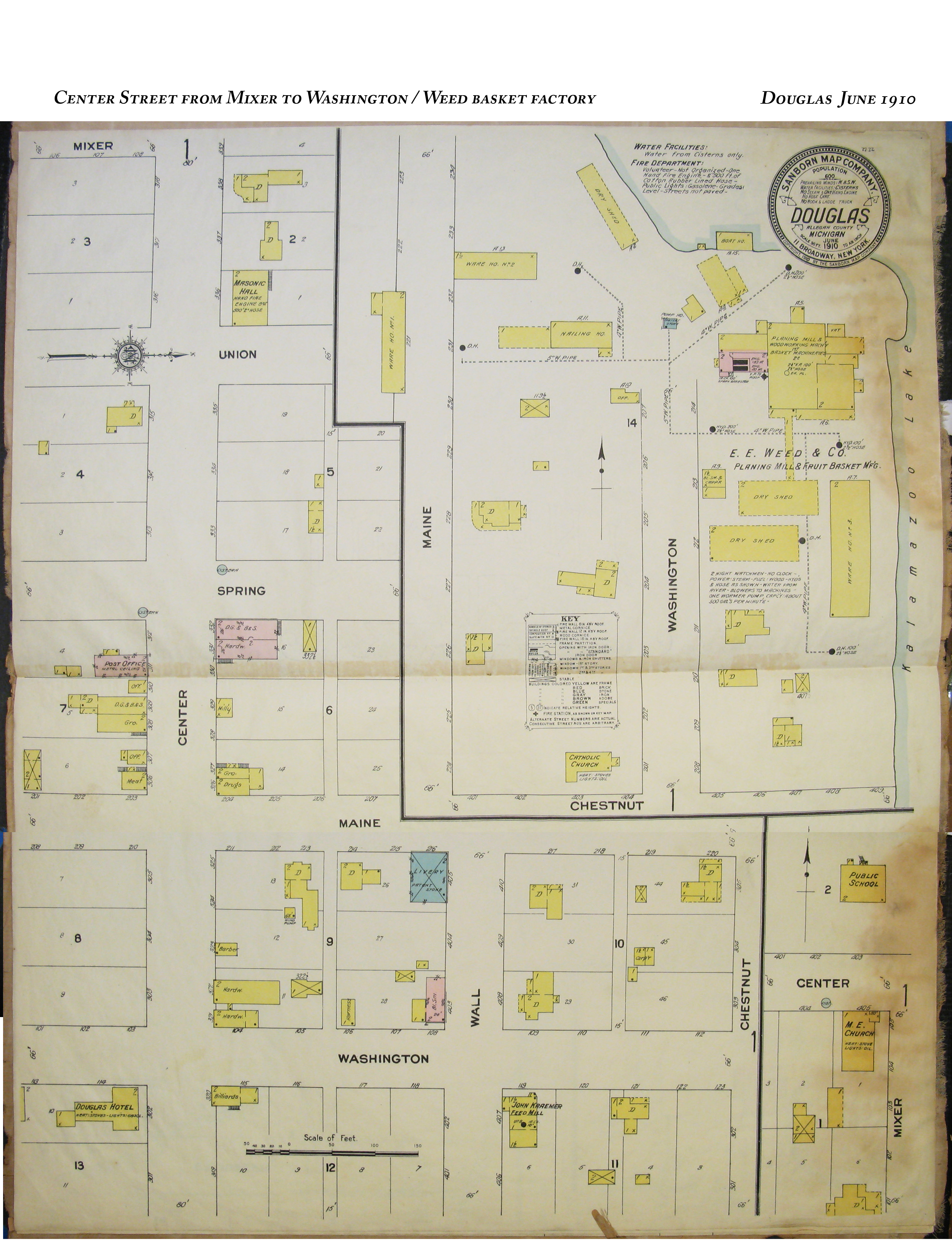
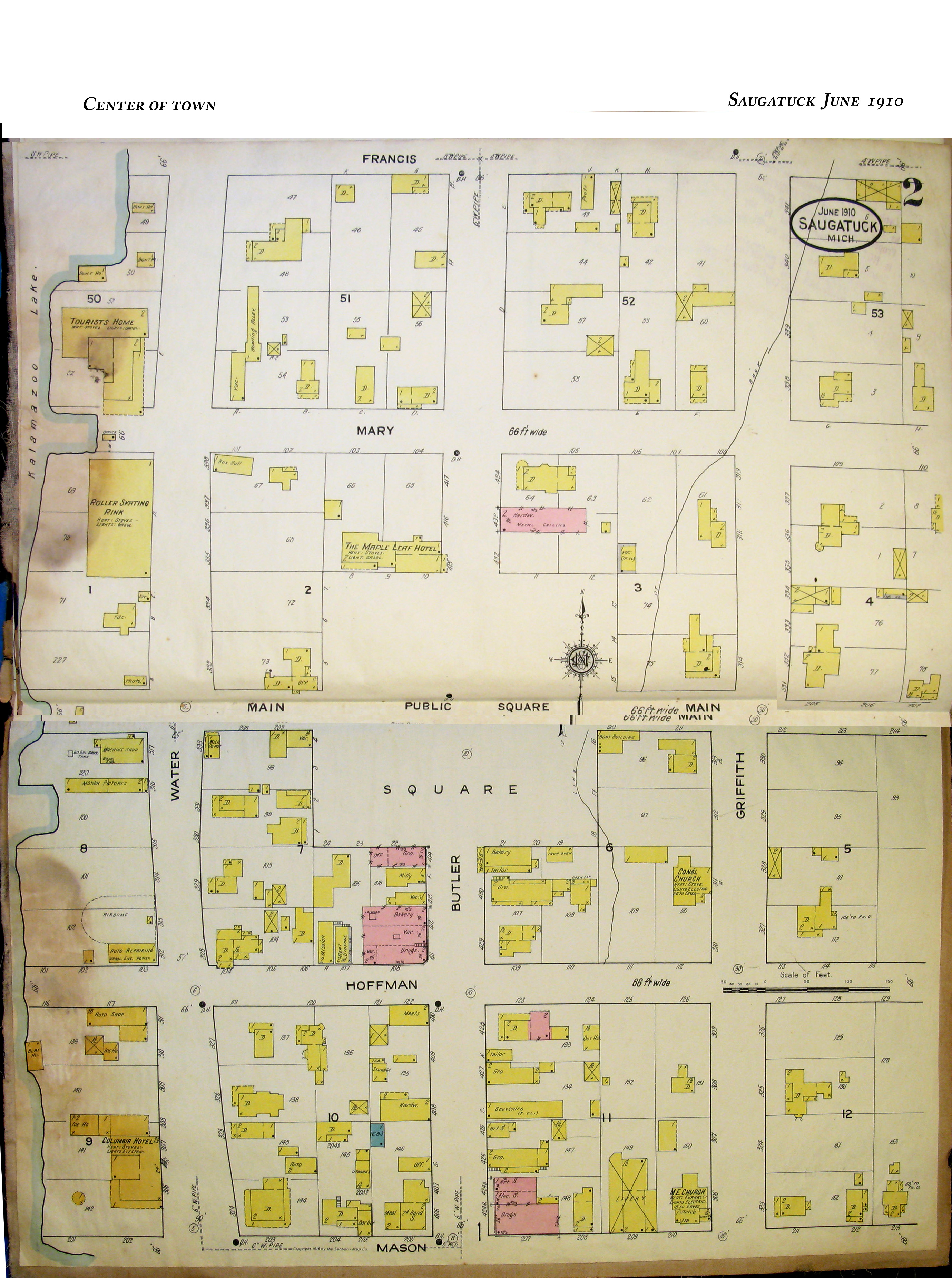
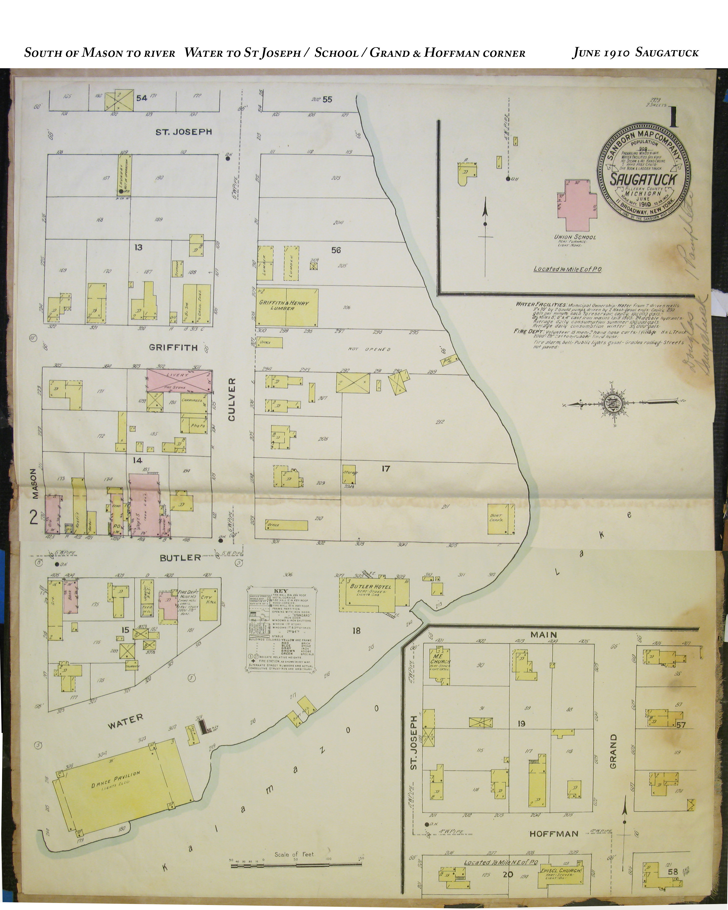
1910 June - Sanborn Insurance Maps from the Henry Brady Collection,
SDHS
----Center St. from Mixer
to Washington/Weed Basket Factory
----Center of Town
----South of Mason to River
Water to St. Joseph/Grand & Hoffman Corner
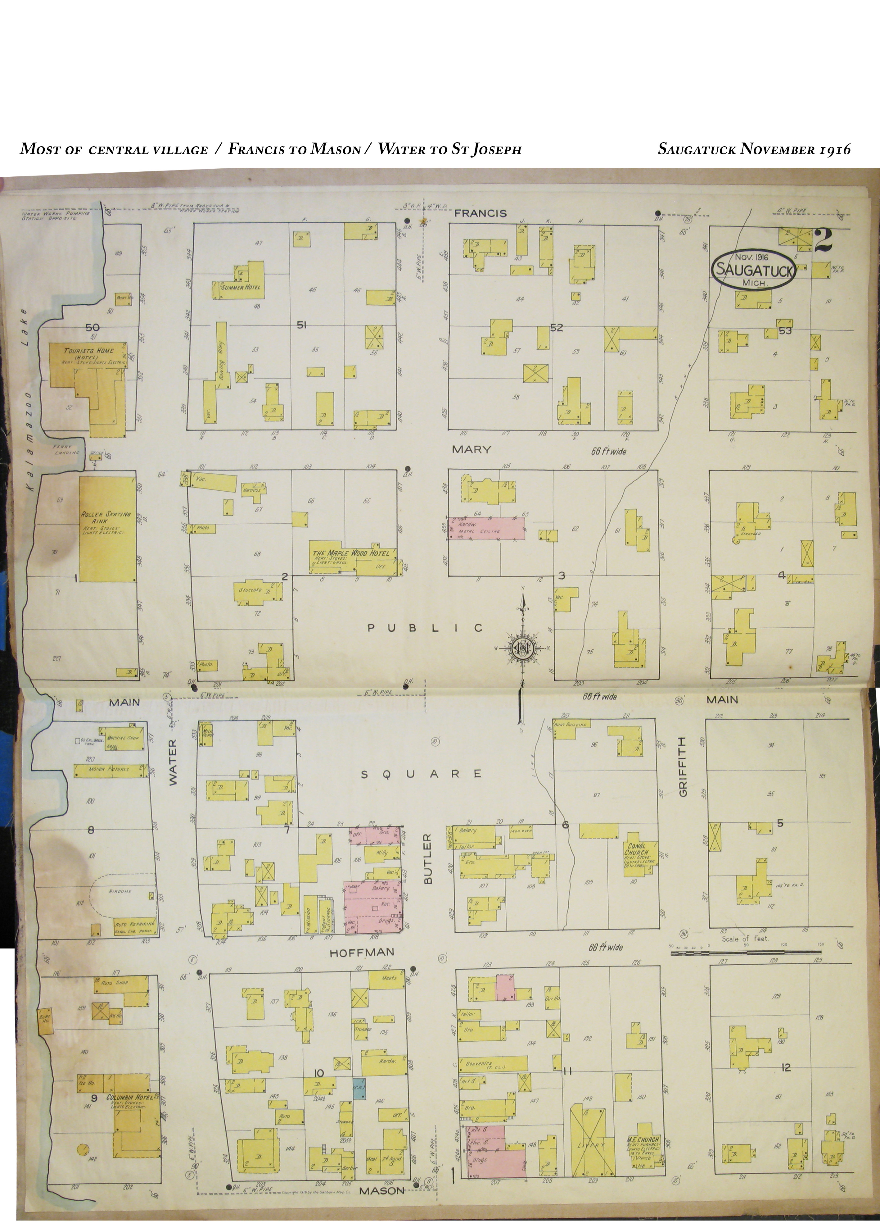
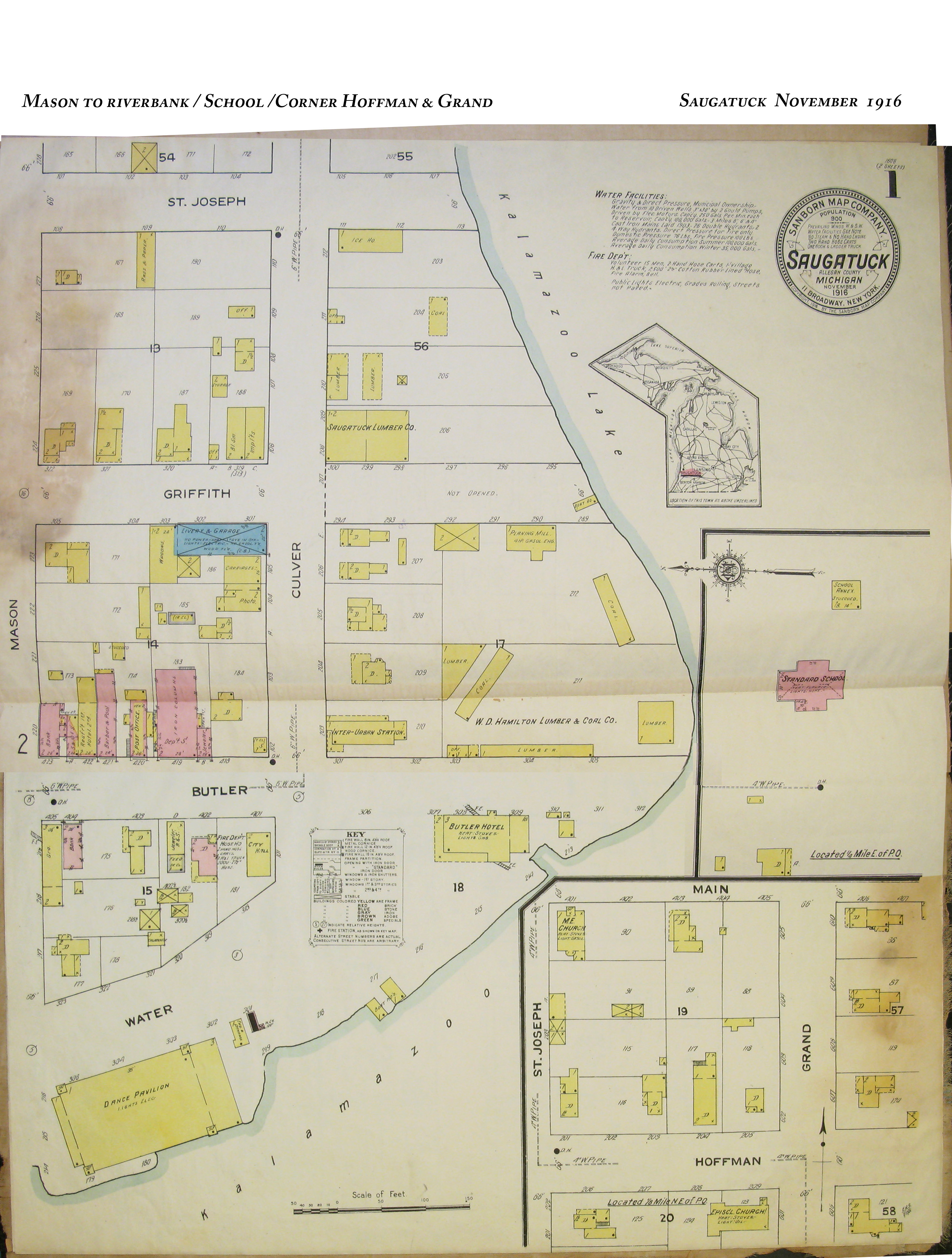
1916 Nov - Sanborn Insurance Maps from the Henry Brady Collection, SDHS
----Most of Central
Village/Francis to Mason/Water to St. Joseph
----Mason to
Riverbank/School/Corner Hoffman & Grand
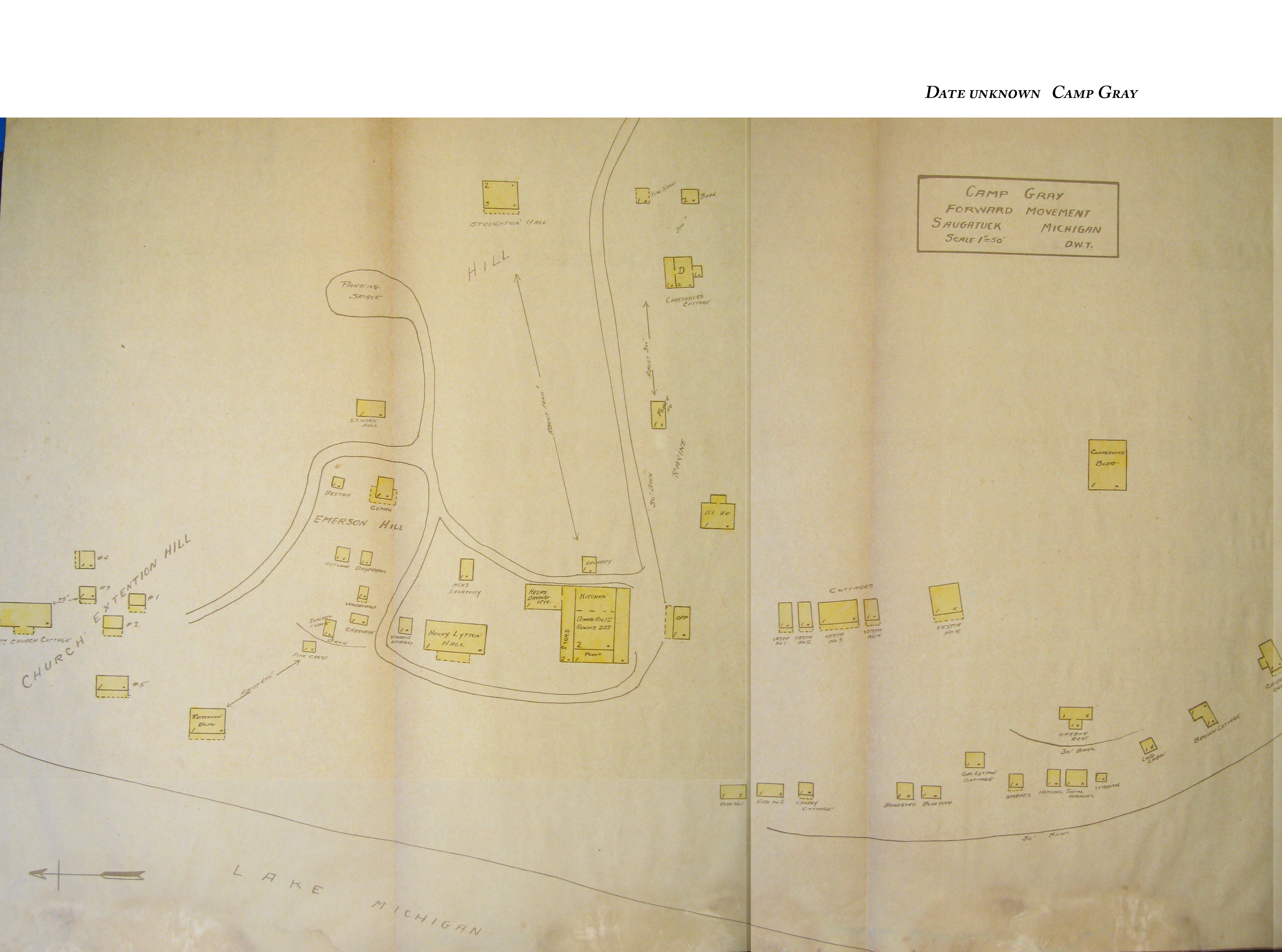
----Camp Gray
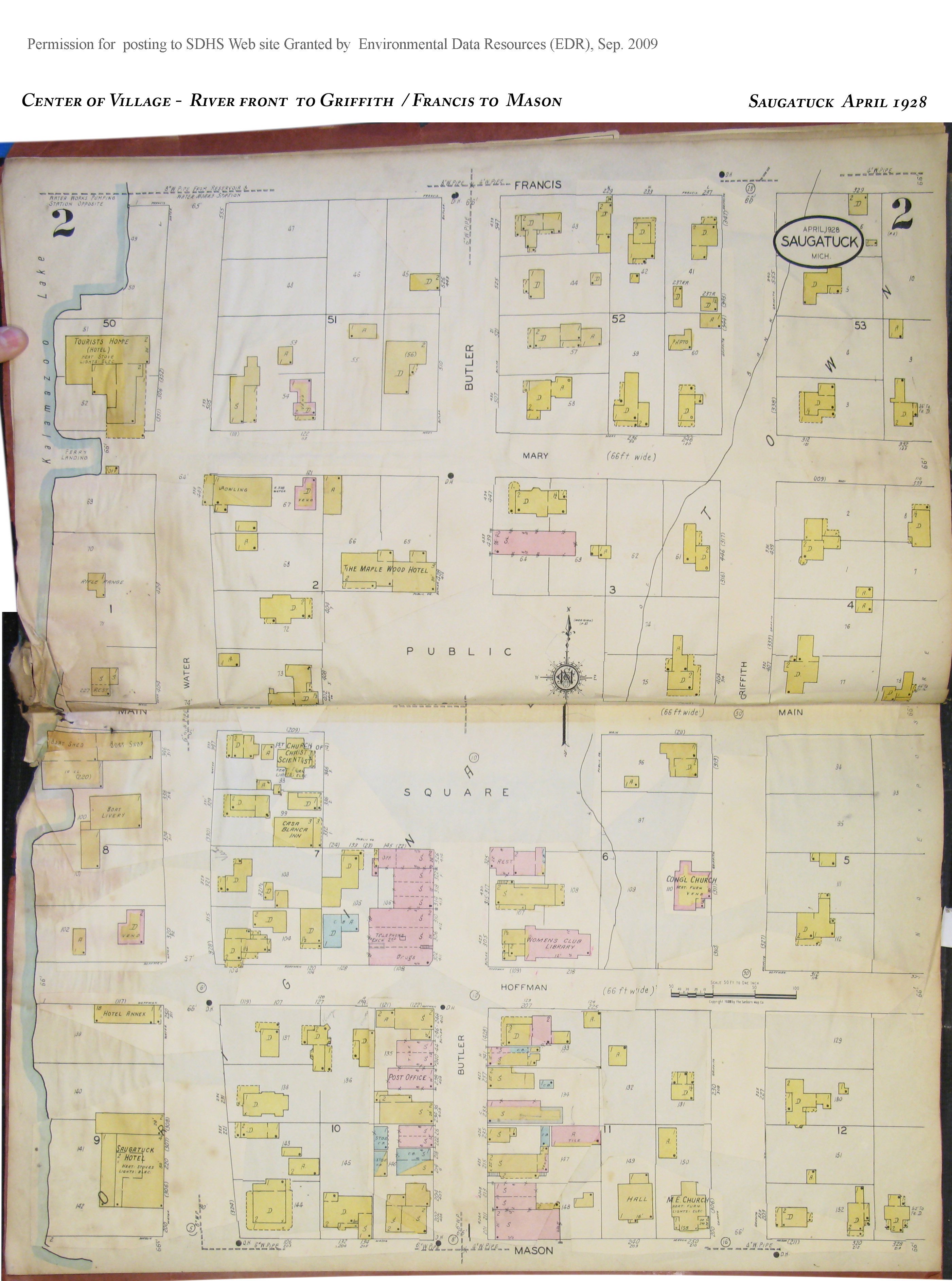
1928 April- With Overlay of Aug 1953 Corrections (Permission to use on
SDHS Web Site given by EDR Sept. 2009, authorization on file)
---Downtown and
East to St. Joseph, Incl. American Twisting, School, Corner of Hoffman and Grand
---Center of
Village, River Front to Griffith, Francis to Mason